Safeguarding Europe’s remote and vulnerable cultural heritage increasingly requires more than traditional documentation and reactive intervention. The ARGUS project responds to this challenge by developing a comprehensive, technology-driven framework for preventive preservation.
Central to this effort are three closely connected reports on data fusion and integration methods, digital twin models, and diagnostic methodologies. Together, these components form a coherent system that enables continuous monitoring, predictive analysis, and informed decision-making for heritage conservation.
At the foundation of the ARGUS framework lies multimodal data fusion. Cultural heritage sites generate and depend on a wide range of data, from satellite imagery and environmental measurements to historical documentation and geometric surveys. This work establishes the methods and workflows needed to integrate these heterogeneous datasets into a unified analytical environment. Through careful spatial and temporal alignment, data from remote sensing, on-site sensors, and archival sources can be combined into consistent, comparable datasets.
This integration is supported by a robust DataOps pipeline designed to manage the full data lifecycle, from collection and standardisation to enrichment, integration, and visualisation. Automated scripts and algorithms ensure data quality and interoperability while adhering to the FAIR principles, making data findable, accessible, interoperable, and reusable. In parallel, ARGUS has explored the use of large language models through a retrieval-augmented generation approach, enabling users to query complex geospatial databases in natural language. This innovation enhances accessibility and supports more transparent validation and interpretation of data, particularly for non-technical stakeholders.
Building on this harmonised data foundation is the cultural digital twin model through the PANOPTES ontology. PANOPTES provides a semantic framework that organises observations, diagnoses, predictions, and conservation decisions into a coherent, machine-readable structure. By aligning with established international standards such as CIDOC CRM, SOSA/SSN, GeoSPARQL, and OWL-Time, the ontology ensures scientific rigour and interoperability with existing heritage data infrastructures.
Unlike static data models, PANOPTES enables a dynamic and asset-centric representation of heritage sites. It integrates three-dimensional geometric models, multispectral and acoustic data, environmental measurements, and climatic indicators into a single evolving digital twin. Importantly, the ontology embeds a “risk memory” based on the ICCROM/CCI ABC method, allowing risks to be assessed, tracked, and revisited over time. Agentic extensions further capture the evolving interactions between heritage assets, environmental processes, and human activities, supporting predictive and reflexive analysis.
Complementing data fusion and semantic modelling, complimentary work focuses on AI-powered diagnostic methods that translate data into actionable insight. These methods are designed to detect abnormalities and emerging threats across multiple data modalities and spatial scales. Machine learning techniques are used to segment and label areas of concern, guiding experts toward targeted inspections and interventions. By leveraging the PANOPTES ontology, diagnostic outputs are directly linked to asset histories, risk profiles, and decision pathways, strengthening their relevance for conservation planning.
Crucially, these diagnostic models are adapted to the specific conditions of each pilot site. Rather than applying a one-size-fits-all solution, ARGUS tailors its analytical approaches to local environmental, structural, and material contexts. This site-specific adaptation increases accuracy while ensuring that recommendations remain practical and meaningful for conservators on the ground.
The true strength of the ARGUS approach lies in the synergy between these three research areas. Data fusion provides the harmonised, high-quality datasets needed for analysis. The digital twin ontology structures and contextualises this information, enabling prediction and reasoning. Diagnostic methods then operate within this framework to identify risks and support evidence-based decisions. Together, they create a closed loop of observation, interpretation, prediction, and action that underpins preventive preservation.
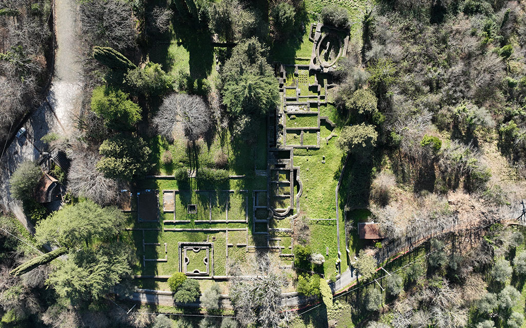
These methods are currently being tested and refined across five diverse European pilot sites. On Delos Island in Greece, ARGUS addresses coastal erosion and salinity through remote sensing and environmental monitoring. In Baltanás, Spain, IoT sensors track humidity and structural conditions in underground wine cellars. Monti Lucretili in Italy serves as a testbed for analysing soil erosion and subsidence using geomorphological modelling and satellite data. At Sant’Antonio di Ranverso Abbey, structural and environmental sensors monitor infiltration and biodeterioration. At Schenkenberg Castle in Switzerland, the focus is on freeze–thaw cycles and vegetation-induced damage, supported by vibration monitoring and UAV-based imaging. Together, these sites demonstrate the flexibility and robustness of the ARGUS framework across different heritage typologies and risk profiles.
Despite these advances, challenges remain. Integrating highly diverse datasets continues to require careful refinement of fusion techniques. Scaling the digital twin and diagnostic models to new heritage contexts demands both technical adaptation and domain expertise. Real-time data ingestion and analysis also pose ongoing challenges, particularly in remote environments. Looking ahead, ARGUS plans to expand the PANOPTES ontology to cover additional asset types and data modalities, refine diagnostic methods to address emerging threats such as climate change and urban pressure, and strengthen citizen engagement through Living Labs and collaborative innovation activities.
The combination of data fusion, digital twin ontology, and AI-based diagnostics provides a comprehensive, scalable, and non-invasive framework for monitoring, predicting, and mitigating risks to remote built heritage. By combining advanced technologies with interdisciplinary collaboration, the project is laying the foundations for a more resilient, preventive, and sustainable approach to safeguarding cultural heritage for future generations.