Cultural heritage sites across Europe stand at a critical crossroads. Increasingly exposed to rising temperatures, extreme weather events, and shifting environmental conditions, these landmarks face accelerated decay and loss.
Traditional conservation approaches—often reactive and restorative—are no longer sufficient to confront the pace and complexity of these challenges. In this context, preventive preservation has emerged as a transformative approach, prioritising anticipation, monitoring, and mitigation before irreversible damage occurs.
At the heart of this paradigm shift are remote sensing technologies and digital twin models, which together offer an unprecedented capacity for real-time monitoring, early warning, and predictive analysis. Remote sensing—through satellites, drones, and miniaturised sensors—enables continuous observation of environmental and structural conditions without physical intervention. When integrated into digital twins, these data streams create virtual replicas of heritage sites, allowing experts to visualise, simulate, and forecast risks with precision. This proactive methodology marks a transition from documenting past deterioration to preventing future loss.
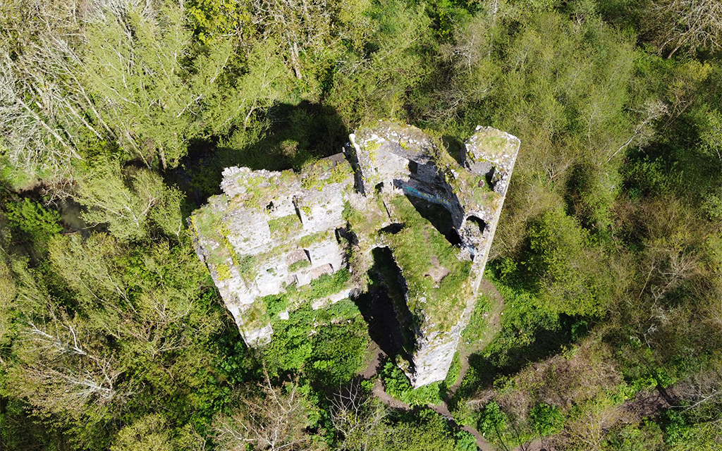
ARGUS combines remote sensing, AI-driven analytics, and digital twin frameworks to design sustainable, non-invasive preservation strategies for vulnerable and remote heritage sites. Its five pilot locations—Monti Lucretili and Sant’Antonio di Ranverso Abbey in Italy, Delos Island in Greece, Baltanás Cellar Town in Spain, and Schenkenberg Castle in Switzerland—represent diverse climatic and structural challenges, from coastal erosion and hydrogeological instability to freeze-thaw cycles and material degradation.
Through on-site campaigns and satellite data integration, ARGUS builds multimodal datasets that feed into its digital twin systems. These dynamic models enable real-time tracking of environmental parameters, structural changes, and potential threats. As a result, conservation teams can predict deterioration patterns, assess risk escalation, and design targeted interventions tailored to each site’s specific vulnerabilities. This integrated, data-driven approach bridges the gap between environmental science, engineering, and cultural heritage management.
Remote sensing applications within ARGUS extend beyond observation.
By leveraging advanced analytics and interoperable frameworks such as PANOPTES, the project transforms raw data into actionable knowledge. This enables the generation of risk assessment maps, the identification of priority areas for intervention, and the creation of decision-support tools that guide policy and management. Importantly, ARGUS’s digital ecosystem ensures that information is accessible and shareable, fostering collaboration among conservation experts, policymakers, and local communities.
Ultimately, remote sensing and digital twin technologies are redefining the future of cultural heritage management. By enabling early risk detection, supporting evidence-based decisions, and integrating multiple disciplines into a unified framework, they represent a decisive step toward resilience and sustainability. The ARGUS project exemplifies how Europe’s commitment to innovation, interdisciplinarity, and ethical stewardship can safeguard its cultural legacy against the growing pressures of a changing climate.
As the impacts of climate change intensify, preventive preservation is no longer optional—it is essential. Through projects like ARGUS, digital technologies are not only preserving the past but actively shaping the future of cultural heritage protection.